Do Ganga River Water Levels Affect Nearby Land? Fact vs. Myth (2026 Real Estate Guide)
When planning to invest in residential land near holy river corridors, one of the most common questions prospective homebuyers ask is: "Do annual monsoon rises in the Ganga River affect residential land safety in garhmukteshwar?"
While it is natural to evaluate hydrology when buying land near water bodies, misunderstandings about elevation, embankments, and regional topography often lead to unnecessary anxiety. In this detailed guide, we separate popular myths from geological facts. Learn why master-planned townships like Ganga Residency remain 100% dry, safe, and flood-proof year-round, making them high-yield investments in Western Uttar Pradesh.
Looking for High-Ground Freehold Plots?
Explore our elevated township master plan on the Ganga Residency Master Plan Page or view current rates on our official Ganga Residency Price List.
Table of Contents
- Key Myths vs Facts Regarding Ganga Water Levels
- garhmukteshwar's Elevation Advantage Explained
- Township Elevation & Infrastructure Walkthrough
- How Ganga Residency Guarantees Flood Protection
- Comparison: Active Floodplains vs. Approved Townships
- Further Real Estate Guides & Legal Insights
- Frequently Asked Questions (FAQ)
Key Myths vs Facts Regarding Ganga Water Levels
Let's directly address the most widespread urban legends regarding Ganga River water fluctuations and compare them with scientific topographical realities:
❌ Myth 1: Monsoons Flood All Nearby Land
Belief: Any residential plot situated within 5–10 km of the Ganga River in garhmukteshwar faces seasonal waterlogging or flooding during peak monsoon discharge.
✅ Fact 1: Natural High Plateau Protection
Reality: garhmukteshwar city and Ganga Residency's location sit on an elevated natural plateau elevated over 15 to 20 meters above the riverbed level. Floodwaters are confined strictly within the designated river channel banks.
❌ Myth 2: Ground Water Levels Cause Foundation Instability
Belief: High river levels elevate soil moisture to a degree that weakens villa foundations or damages construction durability.
✅ Fact 2: Superior Soil Bearing Capacity
Reality: Soil in garhmukteshwar consists of dense, well-compacted alluvial clay and coarse sand, offering exceptional load-bearing capacity for multi-story villa construction without water seepage issues.
❌ Myth 3: Distance from River Equals Zero Water Security
Belief: Plots located at safe elevations lose the advantage of lush greenery and clean eco-zones enjoyed by riverbank areas.
✅ Fact 3: The Best of Both Worlds
Reality: High-ground developments like Ganga Residency and Ganga County enjoy fresh, pollution-free river breezes and dense green surroundings without any flood risk.
garhmukteshwar's Elevation Advantage Explained
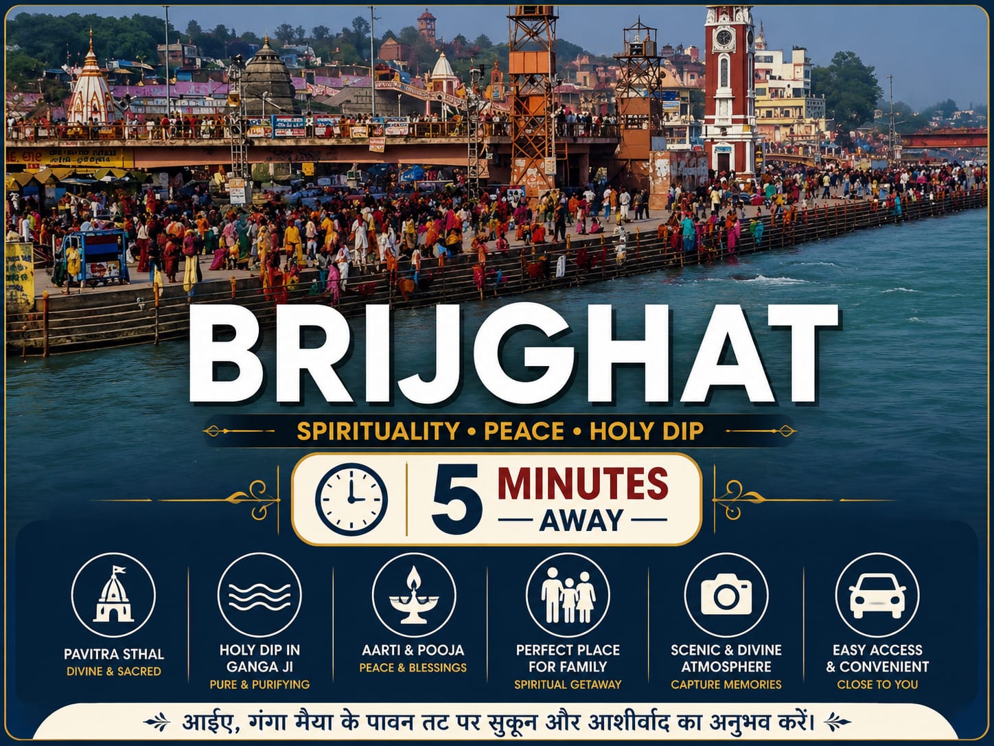
Understanding flood safety requires examining regional contour maps. The river bed at Brijghat sits at a mean sea level (MSL) elevation significantly lower than the mainland township areas.
Government urban planning initiatives, such as the Ganga Expressway infrastructure project, conducted extensive hydrologic surveys before finalizing route maps. Both national highways (NH-9) and approved residential hubs were intentionally positioned along high-contour zones, ensuring decades of uncompromised flood protection.
Township Elevation & Infrastructure Walkthrough
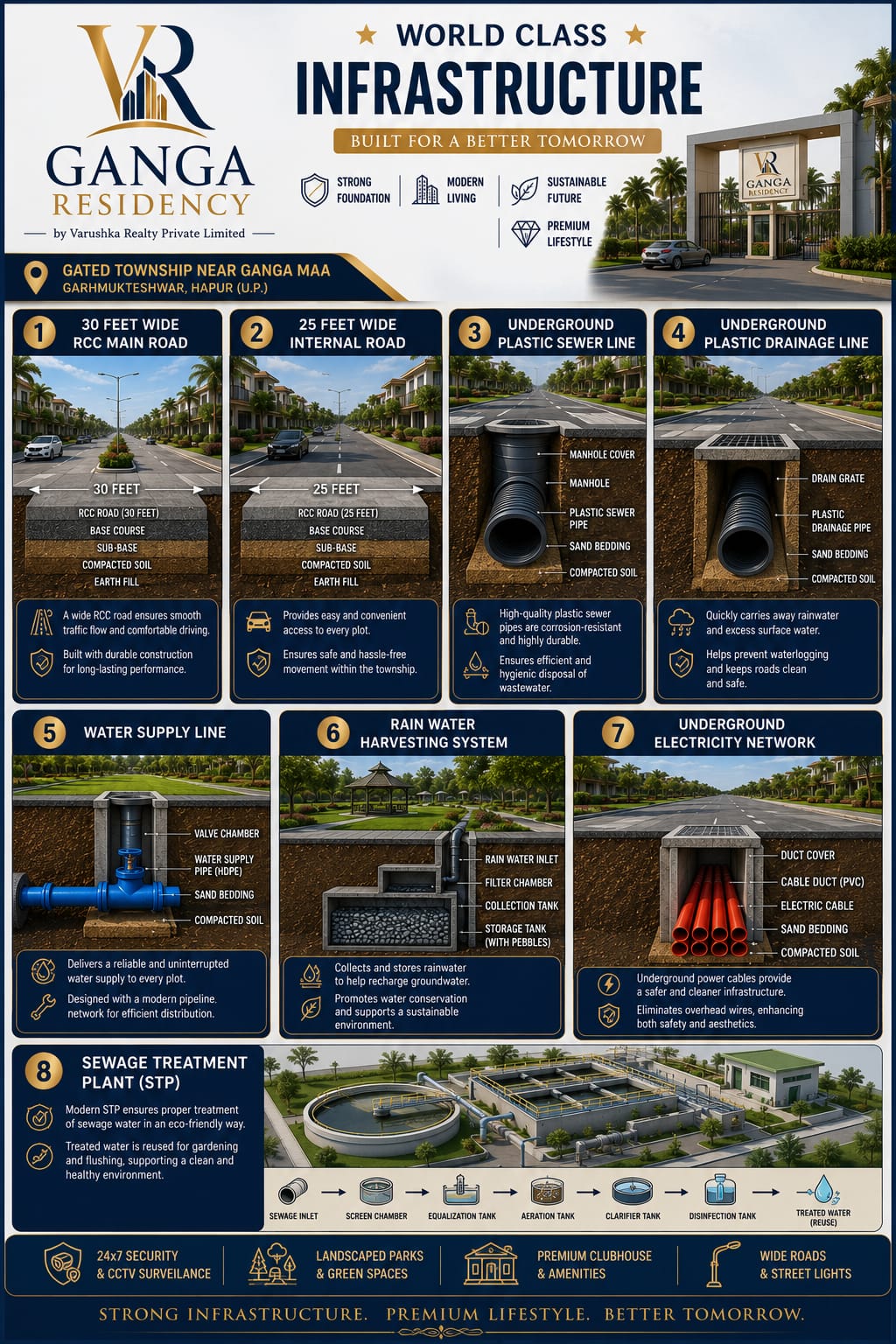
Observe the elevated terrain, wide roads, and modern storm-water drainage networks integrated into our township:
How Ganga Residency Guarantees Flood Protection
At Ganga Residency, township engineering goes beyond natural geographical height. Key civil safeguards include:
- Elevated Internal Road Networks: Internal asphalt roads are built 2 to 3 feet above baseline agricultural ground level.
- Deep Storm-Water Drain Lines: Heavy-duty underground and perimeter drainage conduits ensure rain water drains rapidly during heavy cloudbursts.
- Section 143 Clearances: Full non-agricultural zoning compliance confirms land safety and legal stability. For detailed legal breakdowns, read our Section 143 Legal Approval Guide for Investors.
- Engineered Plinth Levels: Recommended villa blueprints maintain an added 3-foot plinth height above internal road levels.
Comparison: Active Floodplains vs. Approved Townships
Here is how unauthorized floodplain land compares to planned gated townships in garhmukteshwar:
| Factor | Khadar / Floodplain Land (Unapproved) | Ganga Residency (Approved Township) |
|---|---|---|
| Elevation above River | Low (0 to 3 meters) | High Plateau (15 to 20+ meters) |
| Monsoon Water Risk | High risk of submergence | Zero Flood Risk (100% Dry Year-Round) |
| Government Approval | Restricted / Agricultural Only | Freehold Residential / Non-Agricultural |
| Bank Loan Eligibility | Not eligible | Easy Bank Loan Assistance Available |
| Capital Appreciation | Stagnant / Risky | High ROI (Driven by Ganga Expressway) |
Further Real Estate Guides & Legal Insights
Maximize your property research by reading our related guides on garhmukteshwar land investments:
- Why Invest in Residential Plots Near Ganga Expressway?
- Top Reasons to Invest in Residential Plots in garhmukteshwar
- Selecting Vastu-Friendly Plot Layouts for Villa Construction
- Affordable Residential Plots in garhmukteshwar Under 20 Lakhs
- Explore market trends on Medium: Why garhmukteshwar is Delhi NCR's Top Real Estate Hotspot
- Read our twin project comparison: Ganga Residency vs Ganga County Comparison
Frequently Asked Questions (FAQ)
Has garhmukteshwar mainland ever flooded in recent history?
No. The main residential sector of garhmukteshwar and the elevated zones along NH-9 where Ganga Residency is situated have remained completely free from river flooding for decades due to natural high ground elevation.
How does groundwater quality compare near the river?
Groundwater quality at Ganga Residency is exceptional. Being close to the natural aquifer of the Ganga, the water table is sweet, abundant, and easily accessible via deep submersible pumps.
Is it safe to construct a multi-story house or villa here?
Yes. Soil tests confirm high bearing strength suitable for RCC framed multi-story villas, duplexes, or vacation homes.